Free therapy offered to ease Gen Z’s mental health crisis
Depression is today’s leading cause of poor health, according to the World Health Organization. It’s also increasingly affecting young people. Surveys show that depression rates are on the rise among Generation Z; that’s young adults born between the mid-1990s and the early 2010s. Their mental health crisis is so pressing, the health ministry is offering them free sessions of therapy. But what is troubling Generation Z? And what can therapy do to help? We find out in our Sunday special report.
Aside from her full-time job, Stella works as a content creator.
She makes travel and lifestyle videos, handling everything from planning and filming to editing.
Stella
Office worker
It’s a bit like creating passive income. Views come in while you sleep and you get advertising income. Although it’s small, it’s a financial cushion. In the event of getting fired, at least you’d have this small bit of income to support yourself with.
For Stella, juggling a job and a side hustle brings on double the pressure. Her anxiety is made worse by her family and other obligations.
Stella
Office worker
My mortgage payments next year are for my family. I also want to buy a house for myself, because I can’t live with my family forever. So I will be taking on two mortgages.
At 28 years old, Stella is already facing 30 years of mortgage payments. To cope with the stress of it all, she’s turned to therapy.
Over the last decade, depression rates among young adults have grown 20%. Depression disproportionately affects those born between the mid-1990s and 2010s, the so-called Generation Z. In 2023, a study showed that depression in college students had gone up nearly 10% since the pandemic.
Student
You wonder whether you’ll really be able to use what you’re learning, especially in the AI era. Especially in the field of broadcasting. Doesn’t FTV already have an AI anchor named Min Hsi? So we are very worried about whether we’ll be able to find relevant jobs in the future.
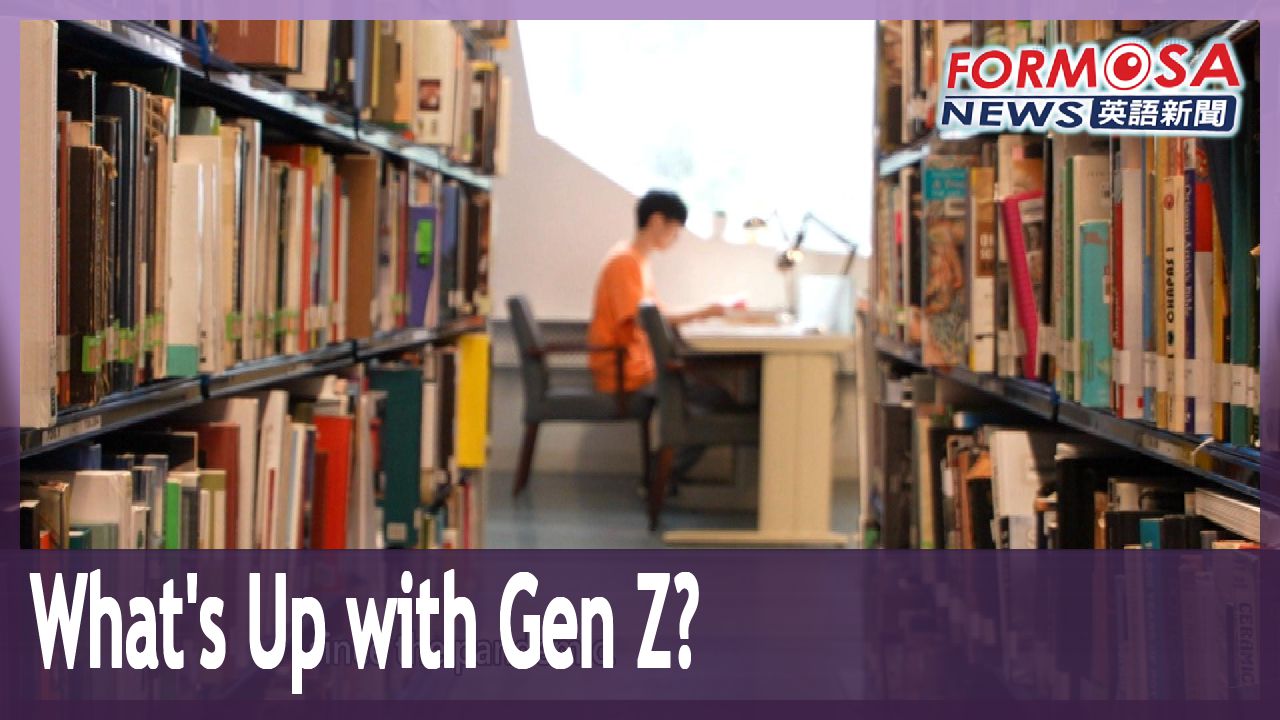
The future is a source of anxiety for Gen Z. Many in this cohort entered university during the pandemic, which restricted their college activities and social circles.
Cheng Hsi
College junior
Before starting college, I thought I would make lots of friends. But then all the activities were canceled. I started to get anxious, thinking, “I’m already here in college, but I’m not learning anything useful, anything really practical.”
Ma Yi-ping
Shih Hsin University therapist
It can’t be denied that online classes are very convenient, but they don’t offer opportunity for hands-on training and learning, like the kind that happens during physical interaction between people. So students returning to campus in their junior year had a rough landing. The schoolwork was stressful and they had to adapt to on-campus social interactions.
Even after graduating and finding employment, young adults face tests in the form of workplace demands and interpersonal relationships.
Stella
Office worker
I think that this is the most turbulent stage of life. Once you’re out there working, you think, “I’ve left school and now I’m free.” But then it turns out you’re not. You have to learn how to navigate the workplace. And getting the job itself is very difficult.
The Gen Z cohort has one main thing in common. Known as digital natives, they grew up on the internet. But spending long periods of time online can lead to feelings of isolation.
Brian
Office worker
I think that social media sets you up to make comparisons, and it’s a very terrible thing. For instance, with my job and my income, there are things I just can’t afford, like a Porsche or a house in Taipei. But just go on any video platform and do a random search, and you will find one or two thousand videos about these topics.
Fortunately, Gen Z is more willing to get help for depression than any other generation.
Cheng Hsi
College junior
I wanted to get therapy, so I first talked to my brother. He said many people he knew were also getting this kind of help. He didn’t think that therapy was anything to be ashamed of.
Without insurance, most 50- to 60-minute therapy sessions range from NT$1,200 and NT$4,000 each. A cycle of treatment is at least four to six sessions, making the cost prohibitive for many students and even some working adults.
Stella
Office worker
For someone who’s just entered the workforce, the cost of therapy can be a real burden. I could spend this NT$1,600 on a fancy meal and really appreciate the value, but spending it on therapy feels like leaping into the abyss.
To make care more accessible, the health ministry launched a policy last August, offering three free sessions to those aged 15 to 30. The policy aims to provide early intervention, to prevent depressive tendencies from becoming more severe mental illnesses.
For therapists, every depression patient is different, but some things are the same.
Ma Yi-ping
Shih Hsin University therapist
The phrase that they all use is, “I’ve been feeling poorly lately.” Ask them about it and they might share issues like poor sleep, or occasionally, crying for no reason. Or there might be feelings of inferiority – signs like that – or ideations of self-harm. These are all signs of depressive tendencies.
Stella has long had trouble slowing down and giving herself a break. But with the help of her therapist, she’s learning to be kind to herself.
Ma Yi-ping
Shih Hsin University therapist
In most cases, my therapeutic mode is talk therapy. In special circumstances, there might be intervention in the form of art, or cards may be used to help patients express their feelings.
For many patients, it’s not easy opening up to a stranger. Following the launch of the free therapy policy, the question was raised, “Are three sessions enough?”
Stella
Office worker
I think that the three sessions helped me understand how to handle my emotions. It helped to normalize the act of seeking help. It also lowered my sense of awkwardness and embarrassment.
Ke Yu-an
Therapist
The point of the three sessions is, first, to encourage people to get help. Second, to provide a resource and referral service. This means that the policy won’t subsidize your entire course of therapy until the very end, but through the three free sessions, you can learn about the resources available to you, who else you can ask for help. In addition to the therapist, there are people at hospitals and your local social welfare agency. An introduction to this is provided in those three sessions.
The free sessions don’t give patients a complete solution, but they can be the start of a counseling relationship. Beyond the three sessions, patients can still access affordable care.
Ke Yu-an
Therapist
Local health bureaus all have in-house psychologists. Cities and counties provide varying numbers of free sessions. Some might subsidize four or six sessions a year. You can also do something that’s like registering at an outpatient clinic, a psychological counseling clinic. You go online to book an appointment, and if you can get an appointment with a therapist, all you pay is a registration fee of NT$200 to NT$600.
Besides making care affordable, what encourages people to get psychological help is a society that normalizes it.
Therapists say that counseling should be thought of as a key that opens a door, allowing the patient’s voice to be heard. They urge Taiwan’s next generations not to struggle in silence, but to reach out and let the light in.
For more Taiwan news, tune in:
Sun to Fri at 9:30 pm on Channel 152
Tue to Sat at 1 am on Channel 53
2024-05-05