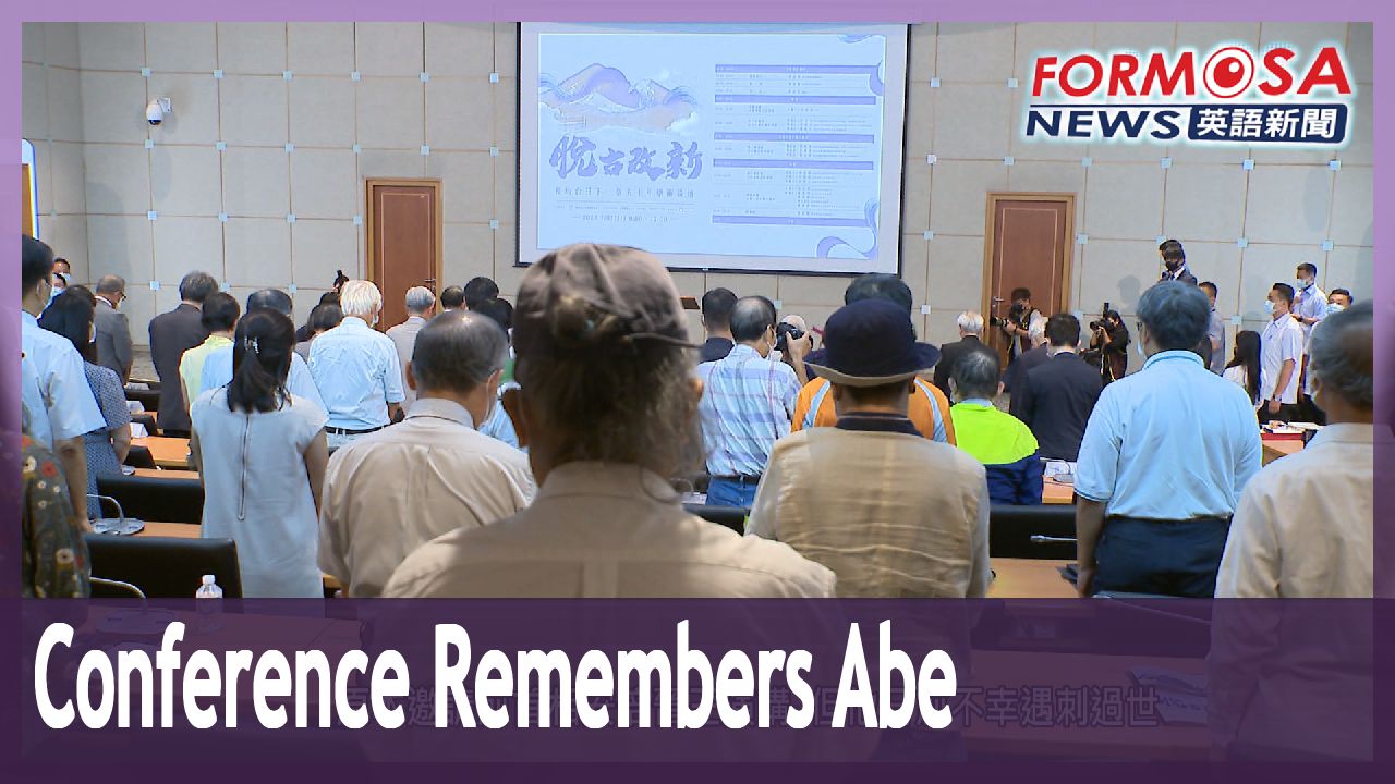
Taiwan’s last few gamadians and the people who run them
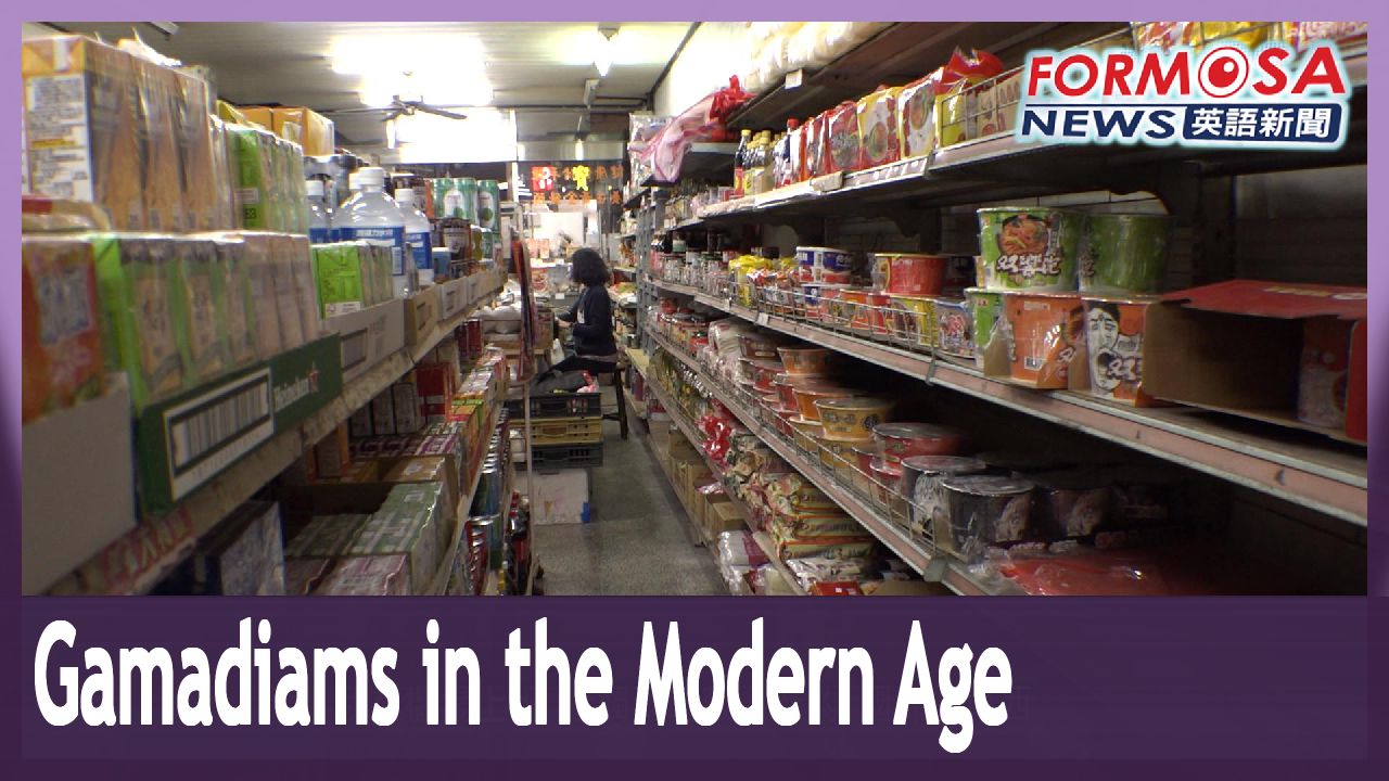
You might have seen them before. Gamadiams are a Hoklo term for traditional Taiwanese corner stores. Gamadiams were once ubiquitous across the country, but they’ve now largely been replaced by convenience stores and supermarkets. Today, we take a trip down memory lane and visit a few of Taiwan’s last surviving gamadiams. Some are decades-old shops still run by their original owners. Others are managed by enterprising young people, who have found fresh ways to keep the tradition alive. Here’s this week’s Sunday special report.
Miaoli’s Shitan Township has only 4,132 people, making it the least populated of the county’s 18 administrative districts.
Lee Shu-min
Shitan Township office
We have about 1,100 residents aged 66 to 79, and about 1,000 residents over 80. So these days in Shitan, when you’re outside walking around, all the people you see will be older people.
What’s unique about Shitan is not just the large number of older adults, but also the large number of traditional grocers – known in Hoklo as gamadiam . In a short span of just 400 meters along the township’s old street, one can find two such traditional grocers. This location is the older of the two. Built in the Japanese colonial days, It has been operating for nearly 70 years now.
The shop is run by 67-year-old Su Ching-chang and his 95-year-old mother.
Su Ching-chang
Independent grocer
I took over running the shop in 1980. This building was originally our house. You could say the business here is pretty good. When people come back to town, they gather here to buy things.
In an age when there were no convenience stores, gamadiams were where everyone in town gathered to shop. More importantly, they were where town folk gathered to connect with each other.
Lee Shu-min
Shitan Township office
Around the sides of the township’s grocery stores, wherever space allows it, we put out chairs for people to rest. The people who live around here have an emotional connection to these stores.
During the Japanese colonial era, there were as many as 50 such grocery stores in Shitan Township. Later, the exodus of people from the town, combined with the arrival of chain stores, convinced most independent grocers there to close up shop. Today only 12 gamadiams remain in Shitan.
Su Ching-chang
Independent grocer
It’s never occurred to me to close up shop, because I’ve got my mother at home here. Mainly I’m here to take care of her, as well as to keep the shop running.
Although business isn’t as good as it used to be, Su still makes a sufficient living. For his community, gamadiams hold a special meaning.
Lee Shu-min
Shitan Township office
In cities, you have convenient public transportation, so if you need to go to the supermarket or the hypermarket, it’s quite easy to get there. But in a place like Shitan, public transportation is not quite as convenient. Therefore, the small grocery shops still have their place.
Traditional independent grocery stores can still thrive in small towns, perhaps due to the lack of supermarkets and hypermarkets. But what about gamadiams found in cities?
Hidden away in Taoyuan’s Liuhe Commercial District in this small, unassuming shop, the fragrance of coffee fills the air.
The owner of this shop is 45-year-old Tseng Han-yi. She has help from her long-time shop assistant and grandmother, 88-year-old Chiu Huei-mei.
This shop is a hybrid of sorts – one side of it is kept in the style of a gamadiam.
Tseng Han-yi
Shop owner
This area over here is our cafe, and on this side is my grandmother’s gamadiam. Due to space restrictions, in the gamadiam, we just put out some of the more commonly sold items. Some things we keep in the back – like these things here. Actually, our customers come back here themselves to get stuff.
Customers are free to walk into the back room, as if it were their own home – and they make small talk with Tseng’s grandmother. For some 10 years now, the shop’s only customers have been the owner’s elderly neighbors.
Tseng Han-yi
Shop owner
Within just 300 meters of us here, there are a dozen or so convenience stores. Within 500 meters, there are two supermarkets. So basically, we lost all of our customers to those stores.
Business at the store has waned over the years, and Tseng’s grandmother no longer has the energy she once did. In 2017, Tseng decided to close up her own coffeeshop. She transplanted her business to her grandmother’s store so that she could help out.
Tseng Han-yi
Shop owner
I thought, whether I take over the gamadiam or merge it with my coffee shop, I want to make some changes to improve business.
Changes and transformations are all in the hope of drawing in customers. Tseng, an animal lover who has a pet hedgehog, turned the cafe-gamadiam hybrid into a pet-friendly establishment.
Wen-chih
Customer
I went online and searched for meetups of hedgehog pet owners, and that’s how I found this cafe. I followed the map here, and when I arrived I discovered the owner has a hedgehog of her own. She’s also really friendly toward pets.
Hsin-chen
Customer
Only after I stepped inside did I realize there was a gamadiam here. Later I brought my kids here. They loved it, because they’d never seen these things before.
Tseng successfully cracked the pet-owners’ market, and increased revenue at the gamadiam by nearly 20%. Taking her grandmother’s sleep schedule into account, Tseng opens the shop at 9:00 a.m. She doesn’t make meals – only coffee – but on whim, she decided to team up with a breakfast shop.
Chang Chieh-chieh
Breakfast shop owner
The shop owners around here are all really friendly. We share resources – it’s about the common good, about coexisting. So, even if it’s just for a club sandwich, I’ll go there, I’ll deliver it to them– I’m really willing to do that.
Tseng Han-yi
Shop owner
I told them, “I’ll order breakfast from you, but since the meat marinade that you use contains rice wine, you can buy that wine from us– because my grandmother sells that stuff.”
Through cooperation and reciprocity, traditional shops in the neighborhood help keep each other alive. Over in Taoyuan’s Xinwu District, this family is also keeping traditional alive.
The Chung family has lived in this townhouse for three generations. They opened a grocery store on the first floor in 1956. In 1986, second-generation owner Chung Hsing-ming took over. With the advent of convenience stores and supermarket, business got harder and harder. Roughly 10 years ago, Chung Hsing-ming’s daughter began helping out, by bringing fresh ideas to the traditional operation.
Chung Pei-ju
Independent grocer
I work at the airport, where I encounter lots of new ideas from other countries. My company tends to engage in group-buying, and sometimes I’d buy something delicious through the group and then want to go buy more, but would have to wait a long time for the chance. Xinwu is really small, and most of the young people here are in junior high or senior high school. So, I decided to start a collective-buying group, to get those young people to come buy stuff at our shop.
The first group purchase that Chung Pei-ju introduced was chocolate from Japan.
Chung Pei-ju
Independent grocer
At that time it was impossible to buy Black Thunder chocolate bars from Japan. You couldn’t find them anywhere in Taiwan. But at the airport where I was working, I could get them. So I started buying them in bulk, to resell. Then everyone started lining up at our shop to get them.
Chung Hsing-ming
Independent grocer
How did we suddenly get so many young people coming to our shop? We didn’t recognize any of them. Some even came from other parts of the country – there were lots of them! It was quite strange. That really piqued our interest.
The Chung family’s gamadiam suddenly became famous. Chung Pei-ju set up a Facebook fan page for the shop, and began looking for the next sales opportunity. But the older people in her family didn’t understand the idea of group-buying. The high price of the items she wanted to buy made them doubt her idea’s earning potential.
Chung Pei-ju
Independent grocer
My father was opposed to my way of doing things, but I had confidence in myself. I thought those imported snacks were really delicious, and I was sure young people would feel the same. So I did it my way and showed my dad that even if I bought that many cakes, I could sell them all. He was really surprised.
In the end, Chung Pei-ju’s older family members saw the success of her methods and came onboard. They learned how to use social media platforms and how to set up collective-buying groups. Over time the number of customers grew, and store revenue grew by nearly 60%.
Gamadiam are a key part of Taiwan’s traditional culture. For the older generations that opened them, they provided good livelihoods. As youth bring fresh ideas into these bastions of tradition, the spirit of the past continues to live on in the present.
2022-07-31