Seismologist explains how areas of Taiwan are shifting due to plate tectonics
Seismologist explains how areas of Taiwan are shifting due to plate tectonics
2022-11-02
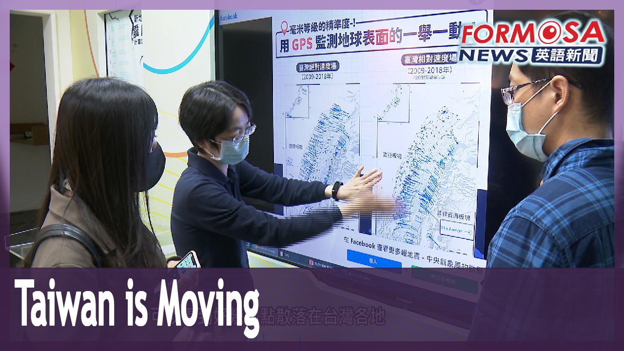
Earlier this week the Central Weather Bureau shared two maps online showing how different areas of Taiwan are moving on the earth’s surface due to plate tectonics. The maps show how some areas of Taiwan have shifted position at a rate of up to 8 centimeters per year between 2009 and 2018. The maps have attracted a lot of attention online, with commenters wondering whether that could mean that Taiwan is slowly drifting away from China into the Pacific.
On Monday evening, another earthquake struck at Taitung’s Donghe Township. Fortunately, no people were hurt. Tremors like these often shake Taiwan, because of the movement of tectonic plates. These ground movements also gradually shift Taiwan’s location in the world.
The Central Weather Bureau recently released two maps showing the absolute speed and relative speed at which different areas of Taiwan moved due to tectonic action between 2009 and 2018. The blue arrows represent the direction of the shift, and their length represents the distance of the movement. The maps left some internet users wondering whether that meant that Taiwan was gradually moving away from China. A seismologist says that’s not the case.
Chao Hsiao-ling
Taiwan Earthquake Research Center
the Eurasian plate covers both west Taiwan and China. They are on the same continental plate, meaning they move in the same direction. Taiwan and China are moving together.
Taiwan is located at the convergent boundary between the Eurasian Plate and the Philippine Sea Plate. Thanks to a network of sensors, researchers found Taipei is moving by 0.5 centimeters every year. Over at the rift valley running through Hualien and Taitung, the speed is 6 centimeters per year. According to the findings, the fastest moving area is Orchid Island, which is shifting toward Taiwan proper at a speed of 8 centimeters per year. The network of 450 sensors provides valuable information on seismic faults and volcanic activity as well as data on subsidence and sliding underground. They hope the data can help scientists find signs that a big earthquake is going to strike. They add that tectonic movements will eventually cause the island of Taiwan to be thinner and more elongated in the future.
Chao Hsiao-ling
Taiwan Earthquake Research Center
This plate is pressing from here, and this other one from over there. So Taiwan will gradually become thinner. Over the short term, it won’t be a difference big enough for anyone to notice a big change.
Seismologists remind that, on a tectonic scale, 10 years is just the blink of an eye. Seeing Taiwan change shape from a sweet potato into a banana will be a matter of several million years, they add.
台灣地震多 大地示意圖板塊看似往東南方移動
2022-11-02
位於板塊交界處的台灣,每年平均會發生4萬次的地震,氣象局公布了十年來的地層變化圖,發現地震的前中後,斷層都會偷偷地移動,由於從示意圖上來看,台灣像是往東南方移動,讓很多網友開心問"離中國越來越遠"? 但氣象局也澄清,中國與台灣同屬於歐亞板塊,其實是一起移動中。
台東縣東河鄉,週一傍晚發生地震,幸好無人受傷。台灣是名副其實的"多震之國"。現在更發現地底下的板塊運動,也讓台灣偷偷移動中。
氣象局公布從2009年到2018年,兩張衛星大地測量示意圖,可以看到好幾個點散落在台灣各地,箭頭指的是移動方向,長度則是移動距離,有網友留言,"離中國越來越遠"?但他們恐怕要失望了。
[[地震中心地球物理課長 趙曉玲]]
“以歐亞大陸板塊來講,台灣西邊跟中國這邊,其實是屬於同一個大陸板塊,也就是說是整個大陸板塊,一樣移動的方向,台灣跟中國是一起在動。”
台灣位於歐亞板塊和菲律賓海板塊的聚合邊界,透過監測發現,台北每年只移動0.5公分,花東縱谷地震很多,每年移動6公分,最好動的是蘭嶼,每年往本島靠近多達8公分。超過450個連續觀測站,讓地球科學家監視斷層、火山活動,以及地層下陷或滑動的一舉一動,希望能找出大地震的發生前兆,而且台灣大番薯的稱號,未來恐怕變成一根香蕉。
[[地震中心地球物理課長 趙曉玲]]
“因為我們可以看這張圖,它是往這邊擠的,這邊是擠過來,台灣基本上就是會慢慢變瘦。短期可能不會變化量這麼大,讓你看到它有明顯的改變。”
但以地球的時間尺度來講,10年的時間只是小小一步,若想要親眼看到台灣從番薯變香蕉,恐怕要等上好幾百萬年。
Related News