CWB may lift sea alert for Typhoon Mawar Wednesday night
CWB may lift sea alert for Typhoon Mawar Wednesday night
2023-05-30
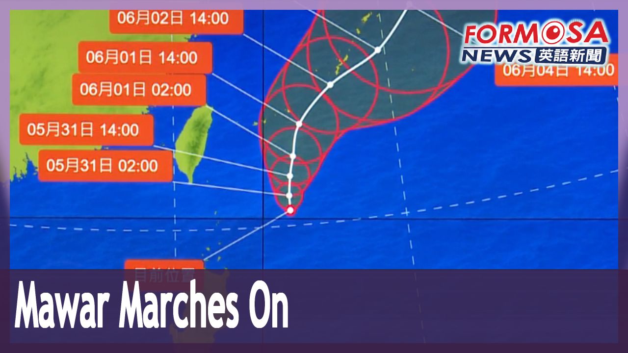
Typhoon Mawar is picking up speed in the seas east of Taiwan, as it continues to batter the East Coast. The storm is barreling north-northeast at 8 kilometers per hour, doubling its earlier speed. The Central Weather Bureau says it may lift its sea alert as early as Wednesday night or early Thursday morning.
As Mawar sweeps through, the northeast and northern mountainous areas will see downpours Wednesday and Thursday, with a chance of localized extremely heavy rains. The East Coast will see heavy rains, which will persist until Friday, even after the typhoon retreats. Also be on the alert for powerful winds. Orchid Island is in line for hurricane-force gusts of 12 on the Beaufort scale. Over at Green Island, winds could hit 11 on the scale. As the storm moves north, wind speeds are expected to intensify in the western half of the island.
東北部.北部山區防豪雨 最快週三深夜解除"瑪娃"海警
2023-05-30
"瑪娃"颱風的移動速度稍微加快,從每小時4公里稍微增快到8公里,向北轉北北東前進,持續對東半部帶來威脅,氣象局預估最快要週三深夜或周四清晨,才有機會解除海上颱風警報。
氣象局表示,週三、週四降雨熱區集中在東北部及北部山區,要留意局部豪雨,東部地區也會有局部大雨的可能,降雨將持續到周五颱風逐漸遠離之後。除了降雨之外,離島的蘭嶼也要留意最大12級的強陣風,綠島、澎湖風速預估也會達11級,隨著颱風北上,西半部的風速也會增強。
Related News