Taiwan’s new national ocean radar network makes beach days safer
Taiwan’s new national ocean radar network makes beach days safer
2026-09-15
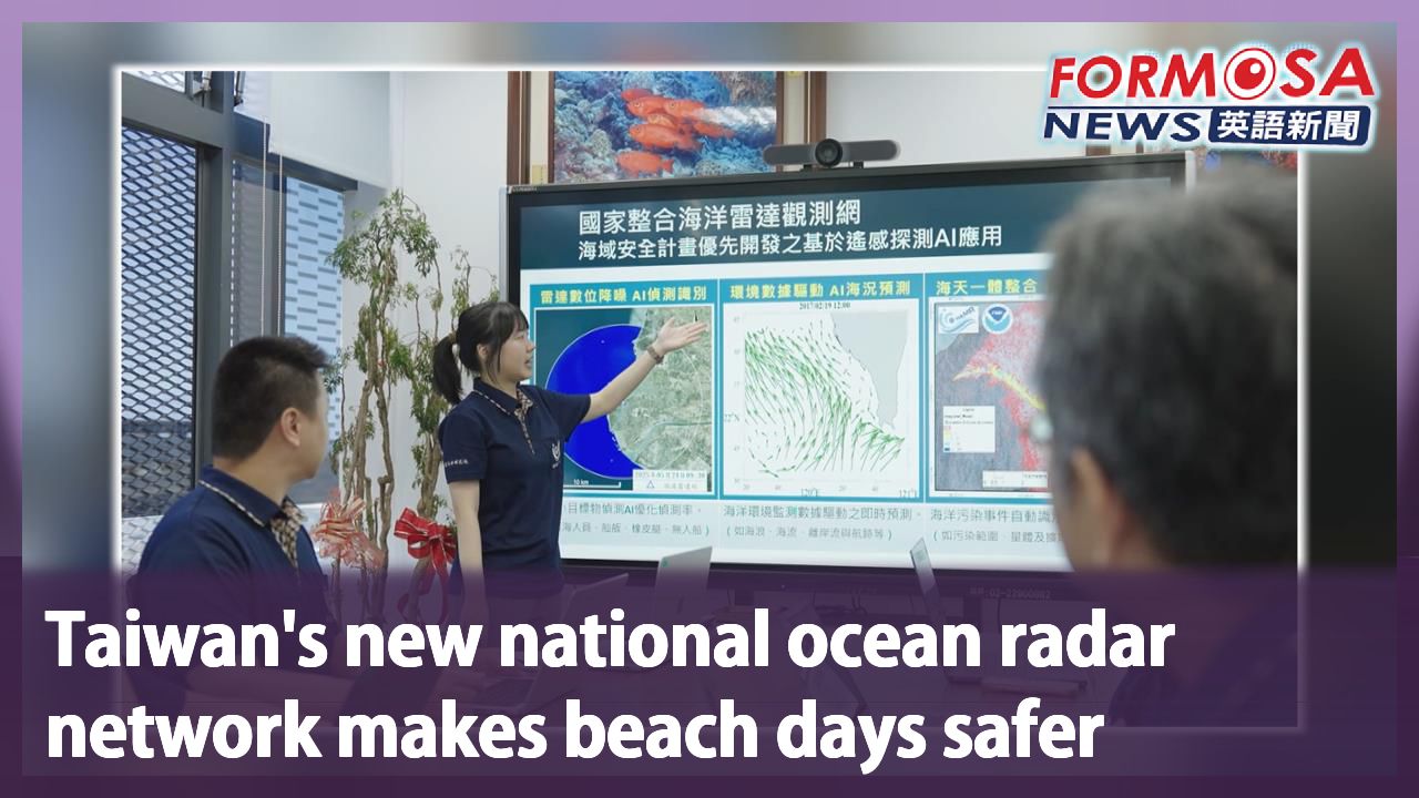
Taiwan is setting up a national ocean radar observation network, linking 59 radar stations across the island’s surrounding seas. It’s the result of interagency collaboration from the likes of the Ocean Affairs Council, National Academy of Marine Research and other ministries. By integrating AI with real-time ocean current data, the system can do things like help predict the drift paths of people who have fallen overboard, securing precious time for rescue operations. Aside from contributing to beach safety, it’s also strengthened surveillance of strategic areas. Let’s find out more.
Combining live-action footage with animation, we take you on a journey through the process of developing Taiwan’s ocean radar observation network.
Kuan Bi-ling
Ocean Affairs Council
We are moving forward from this starting point, and there is certainly a great deal of work ahead of us—ensuring system stability and data accuracy, achieving precise interpretation, and enabling effective utilization. We have reached a total of 59 units to date, as the systems at Yuguang Island and Cijin are now operational; we will continue to press ahead with this initiative.
Marine radar systems are being progressively deployed across Taiwan and integrated with AI applications to create a connected network covering the nation’s waters. This initiative not only enhances safety for marine activities and recreation but also eliminates previous monitoring blind spots, prioritizing the reinforcement of key strategic maritime areas.
Chen Chung-ling
National Academy of Marine Research
Following the deployment of marine radar systems, we will further implement AI applications—such as for detecting rip currents near beaches. Looking ahead, the ability to monitor rip currents and broader ocean currents will prove immensely beneficial for civilian disaster prevention, maritime navigation safety, oil spill dispersion tracking, and search-and-rescue operations.
Through interagency cooperation and technical exchanges, maritime security monitoring and disaster response capabilities are being enhanced, adding another layer of protection to Taiwan’s maritime security.
For more Taiwan news, tune in:
Mon to Fri at 9:30 pm on Channel 152
Tue to Sat at 1 am on Channel 53
#radarsystems #marine security #Taiwansecurity #beachsafety #watersafety
59座海洋雷達建置完成 "導入AI助攻"守護台灣海洋安全
2026-09-15
海洋委員會、國科會、交通部以及國海院跨部會合作,建置國家海洋雷達觀測網,59座海洋雷達串起全台海域。結合AI與即時海流數據,一旦有人落海,就能協助研判漂流路徑,爭取寶貴救援時間。同時填補過去海洋監測盲區,補強關鍵戰略海域,讓科技成為守護海洋安全的重要力量。
實景拍攝搭配動畫,帶大家回顧海洋雷達觀測網,一路發展的歷程。
[[海洋委員會主委 管碧玲]]
“我們要從這個起點往前走,接下來我們要做的工作當然很多,我們如何讓系統穩定,如何讓資料精確,如何能夠精確的判讀,能夠有效的運用。到今天已經是59座了,因為我們在漁光島,在旗津的兩座也都已經上路,未來這個計畫會持續努力下去”
全台海洋雷達陸續建置,更進一步導入AI應用,串聯全台海域,不只提升海洋活動與遊憩安全,同時填補過去海洋監測盲區,優先補強關鍵戰略海域。
[[國海院院長 陳璋玲]]
“海洋雷達建置之後呢,我們也會針對像海灘邊的離岸流的偵測,做進一步的AI應用。未來能夠針對離岸流的部分,整個大海域的海流,對我們講的民生防災,還有航安,包括油污染的擴張,還有人員搜救等等,事實上都有非常大的助益”
跨部會合作,透過技術交流,提升海域安全監控、災害應變,為台灣海洋安全再添一層防護。
更多新聞內容,請鎖定:
民視台灣台(152頻道)週一至週五晚上9:30
民視新聞台(53頻道)週二至週六凌晨1:00
Related News