Heavy rain expected as weakening Typhoon Champi approaches Taiwan
Heavy rain expected as weakening Typhoon Champi approaches Taiwan
2026-10-21
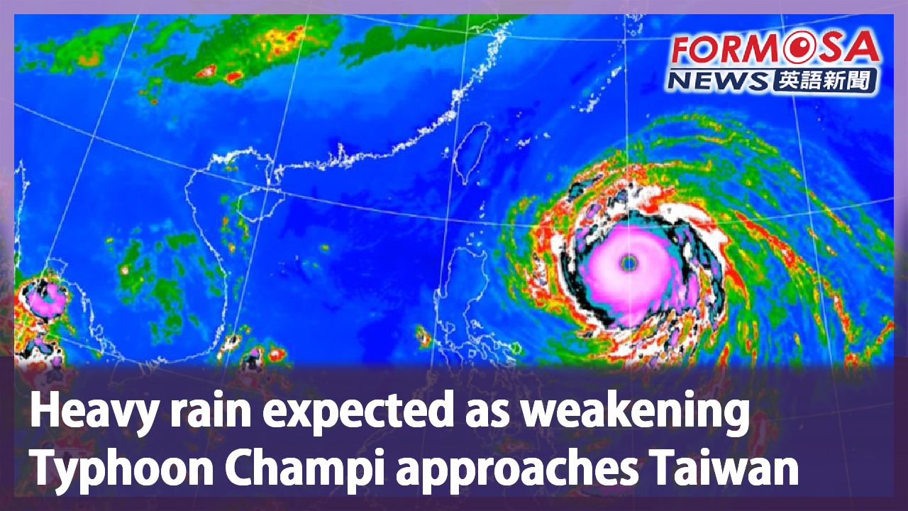
Typhoon Champi continues approaching Taiwan from the east. Though the storm is gradually weakening, the storm circle remains defined. Forecasters expect to issue a land warning at some point after Thursday evening. The storm will be closest to Taiwan on Friday, so be sure to make all the necessary preparations. Let’s hear from a forecaster.
Chang Cheng-chuan
Central Weather Administration
We expect the storm to reach waters off the east coast of Taiwan on Thursday. On Friday and Saturday, it will veer north in waters off the northeast coast. The projected path has been adjusted westward a bit in comparison with the predictions earlier today. That means its shift north will be a bit slower. The point at which the change in direction happens will impact how close it will get to Taiwan.
The storm and northeasterly winds are set to bring rainy weather to the north and east coast of Taiwan on Thursday. Stormy conditions will take over Taiwan on Friday, when the typhoon will be closest to Taiwan. Northwestern Taiwan could see extremely heavy rains of more than 300mm. The rainy conditions won’t ease until after midday on Saturday, when Champi heads off towards Japan.
For more Taiwan news, tune in:
Mon to Fri at 9:30 pm on Channel 152
Tue to Sat at 1 am on Channel 53
#typhoon #storm #champi #rain #winds
薔琵稍減弱"路徑略往西修" 氣象署:暴風圈籠罩北部.東部
2026-10-21
颱風薔琵持續朝台灣東部海面接近,過程中有稍稍減弱,不過暴風圈依舊紮實,氣象署預估週四傍晚之後發陸警,週五是颱風影響台灣的關鍵時段,民眾記得提前做防颱準備。
[[氣象署預報員 張承傳]]
“預計到了明天(22日)的話,就會來到東部外海,到了週五、週六,中心會從東北方的外海通過北上。路徑部分,跟昨天還有上午比的話,有略為比較偏西修,代表它北轉的時間,有稍微比較慢一點,北轉的時間點快慢,會影響到它接近台灣的(遠近)”
氣象署預估,週四,東北季風的雨、加上外圍環流的水氣,整個北部、東部明顯有雨,週五全台都得戒備,颱風最靠近,風雨最大,北東留意豪雨以上等級,累積雨量可能來到 300毫米以上,要到週六下半天過後,颱風北轉往日本,雨勢才會慢慢減緩。
更多新聞內容,請鎖定:
民視台灣台(152頻道)週一至週五晚上9:30
民視新聞台(53頻道)週二至週六凌晨1:00
Related News