Rains batter Kaohsiung, refilling reservoirs
Rains batter Kaohsiung, refilling reservoirs
2023-06-12
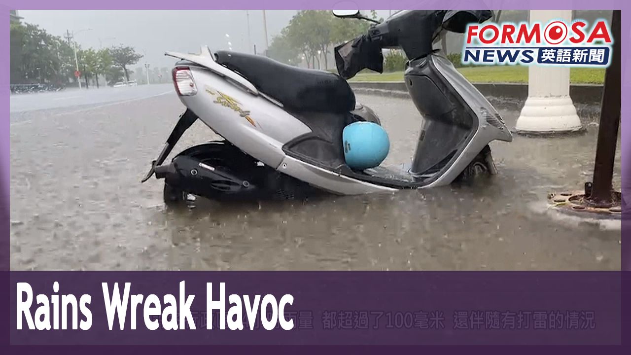
Heavy rains are battering the south, with some areas reporting more than 100 millimeters in just 24 hours. Early morning thunderstorms added to the chaos for commuters. Forecasters warn that Taiwan is currently under a low-pressure zone that’s making the weather highly volatile. The rains may persist throughout this week, as another plum rain front approaches the island.
This is Fengshan Station in Kaohsiung. Workers rush to clear water from the underground parking lot.
Outside, it’s raining hard. And inside, water drips from the ceiling. Workers say the electrical system may be flooded.
Flooding was also reported near Bade Road in Renwu District. Residents say that ongoing drainage work had caused rainwater to pool.
Member of public
It’s just a little construction work on the sewage system, but it’s all flooded now. It’s ridiculous.
Over on Sianfong Road and Jhihseng Road in Zuoying District, the rains loosened the soil and caused several trees to fall. No injuries were reported.
Heavy showers have battered Kaohsiung since the early morning. More than 100 millimeters over 24 hours was reported in several districts, with constant lightning strikes. The storm led to several traffic mishaps during the morning rush hour. But rains in Tainan and Kaohsiung had a positive effect on local reservoirs.
Voice of Ho Ta-fu
Southern Region Water Resources Office
As of 10:30 a.m., Tsengwen and Wushantou reservoirs had a combined 98.4 million cubic meters of water. That’s about 16.81% of their combined total capacity. Nanhua Reservoir had 39.15 million cubic meters, and was at 43.75% capacity.
Liu Yu-chi
Central Weather Bureau
Today is the day with the most significant rainfall. On Tuesday and Wednesday, the front will be closer to the south of Taiwan and the Bashi Channel, so the south will see heavier rains. Low pressure zones could bring bigger uncertainties to the forecast for this week.
In the coming week, the rains will be concentrated in central and southern Taiwan, though the north may also see brief downpours. Meanwhile, Tropical Storm Guchol continues on its path away from Taiwan. It’s not expected to make landfall, but the west coast and Hengchun Peninsula should still be on the alert for big waves.
雨彈狂炸! 高雄多處積水 曾文.南化水庫進帳
2023-06-12
南部地區下起了大雨,其中高雄市多個行政區,24小時雨量都超過了100毫米,一大早市區也出現雷雨狀況,有些地方甚至因而積水。氣象局示警,台灣處在低壓帶,天氣非常不穩定!週二還有梅雨滯留鋒,來報到,預估全台有雨,可能會下到週六。
不過曾文水庫也期待靠著這波梅雨進帳,紓解旱象。
高雄鳳山火車站,地下一樓的停車場積水,工程人員忙著掃水清理。
雖然外頭下大雨,不過車站裡頭可不應該跟著下小雨,初步懷疑是電路管線漏雨。
仁武區的八德路附近,一早也出現積水的情況,附近住戶說,是雨水排水工程動工,才導致積水。
[[附近住戶]]
“這個才施工一點,地下水的污水處理一點點而已,我們這裡就淹水了,很扯、很扯”
至於在左營區的先鋒路和至聖路上,都有路樹因為降雨導至泥土鬆軟,整棵大樹倒了下來,還好沒有人員受傷。
高雄地區一早降下大雨,許多行政區24小時雨量,都超過了100毫米,還伴隨有打雷的情況。民眾一早出門上班上學,雨天行車狀況不少。降雨集中台南、高雄,也讓曾文和南化等水庫,有所進帳。
[[聲源:南水局副局長 何達夫]]
“曾文、烏山頭水庫,在今天上午十點30分,合併的蓄水量是9840萬立方公尺,蓄水率16.81%,那在南化水庫的部分,是3915(萬)立方公尺,蓄水率是43.75%”
[[氣象預報員 劉宇其]]
“今天(12)的話,算是雨勢比較明顯的一段時間,到了13號、14號,鋒面比較是在台灣南部跟巴士海峽,因此降雨的話,還是以南邊是比較居多的。剛剛提到低壓帶,確實也讓這禮拜的天氣預報不確定性,變得比較大”
未來一週降雨熱區集中中南部,但不排除北部也有短延時強降雨,另外,輕颱谷超正在遠離台灣,預估不會為台灣造成影響,但東半部及恆春半島,仍要留意長浪。
Related News