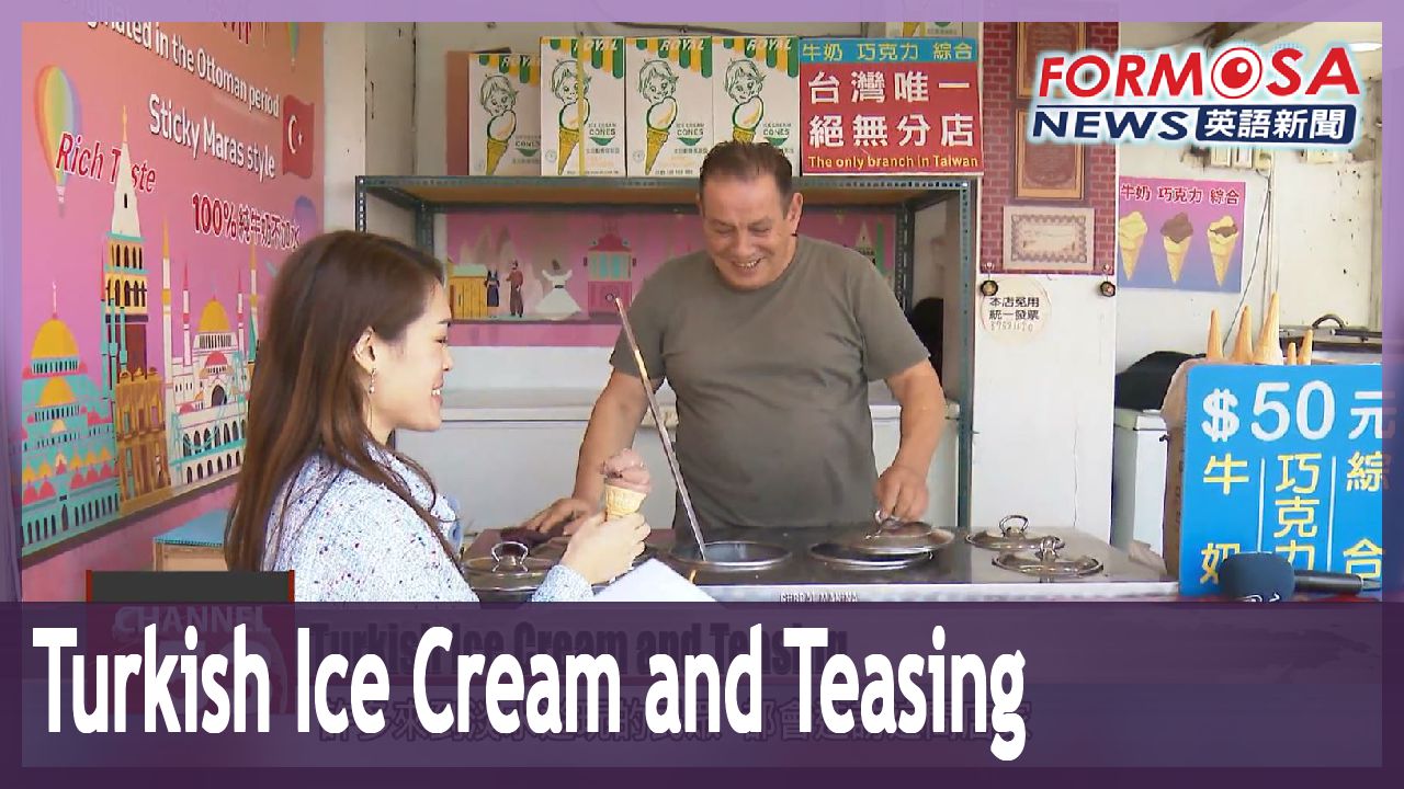
Turkish ice cream seller entertains patrons with ice cream and pranks
Today, we take you to meet Kemal Demir, an ice cream seller from Turkey. Demir has been delighting his customers in Tamsui for 23 years with dollops of Turkish ice cream. The experience is not only just tasty but also a good laugh as he also plays pranks on his customers. The tricks are actually a Turkish tradition, which delight tourists and Taiwanese alike. FTV reporter Stephany Yang was one of his recent victims. Let’s see what happened.
He scoops up a generous portion of ice cream, puts it in the cone, and then hands me an ice cream cone before quickly pulling the cone away.
This stall is a favorite among many visitors when they visit New Taipei’s Tamsui, because this is not an ordinary ice cream shop. This seller will surprise his customers with all kinds of tricks. Not only does it test the customer’s reflexes, but also their patience.
Member of the public
I think it’s fun, because the owner controlled it so the ice cream doesn’t fall to the floor. He was fantastic.
Member of public
I’m very happy. I was worried about Turkey, so I came to talk with him. I really respect that he works hard.
This Turkish ice cream is called maras. The ice cream is made out of goat milk and the roots of wild orchids. The owner of this vendor is Kemal Demir. Originally from Turkey, he has been making Turkish ice cream for almost 50 years. He learnt the trade at just 10 years old and opened up his first ice cream shop when he was 16. In 2001, he opened up a stall in Tamsui. All the ingredients he uses are from Turkey. He wants to introduce Turkish culture to Taiwanese people.
Kemal Demir
Store owner
The city I am from is where the ice cream originated from. I came to Taiwan 23 years ago, and I am now 63 years old. Taiwanese people are nice, and everyone will say “hello” to you. It’s all handmade, and it takes around five hours to make ice cream like this.
Demir says his family and friends were greatly affected by the 7.8 magnitude earthquake in Turkey and Syria. After he contacted his family in Turkey, he learned that his daughter, son, daughter-in-law and granddaughter were all safe, but more than 20 of his other relatives had passed away. He says he is planning to visit Turkey next month.
Kemal Demir
Store owner
I will go next month. Many of my relatives and friends have passed away. I’m quite upset. But, many people in Taiwan have come here to buy things, and I am very grateful for their help. They encouraged me and tell me to keep going, which makes me very happy. Thanks, Taiwan.
Having lived and worked in Taiwan for 23 years, Demir is still passionate about his craft. He says his son will move to Taiwan to help run the business in the future. The family hopes to continue to delight visitors with their creative tricks and teasing, and introduce Turkish culture to more people around the world.
2023-02-22