Impact from Tropical Storm Pulasan may be minimal
Impact from Tropical Storm Pulasan may be minimal
2024-09-16
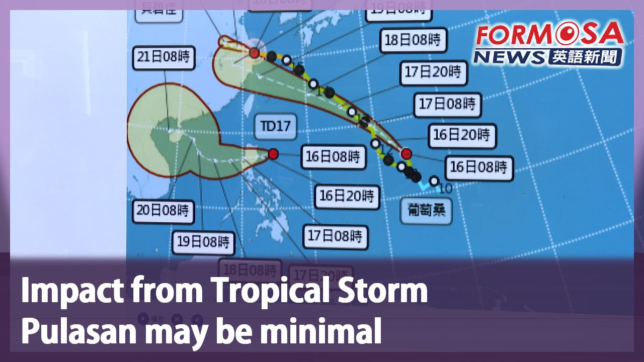
Two tropical storms are currently active in the Western Pacific: Bebinca and Pulasan. And a third one could be on its way. A tropical depression south of Taiwan is expected to strengthen into a storm called Soulik on Tuesday. The storm is set to head straight west across the South China Sea, far away from Pulasan. Let’s hear from the Central Weather Administration.
Huang En-hung
Meteorologist
Tropical Storm Pulasan is expected to track northwest to west-northwest past the Ryukyu Archipelago to ultimately make landfall in Central China. It may oscillate north and south somewhat, but it will remain rather weak. So the main factor affecting the weather in Taiwan is still the moisture in northeasterly winds led by the storm’s periphery.
Pulasan will be closest to Taiwan on Thursday, but it is not expected to have a significant impact on the weather. After the Mid-Autumn Festival on Tuesday, Taiwan will be left in a low pressure zone. That means rainy weather is on the forecast for the first day back at work in the north, east and south of the island.
For more Taiwan news, tune in:
Sun to Fri at 9:30 pm on Channel 152
Tue to Sat at 1 am on Channel 53
葡萄桑和"準"蘇力共舞 距離遙遠估不會出現"藤原效應"
2024-09-16
目前西北太平洋有"貝碧佳以及葡萄桑"兩個颱風,但第17號熱帶性低氣壓,也在周一早上形成,很有可能在週二增強為輕度颱風"蘇力"。預估路徑會是在南海一帶,和葡萄桑距離很遠,因此氣象署也表示,並不會產生藤原效應。
[[氣象署預報員 黃恩鴻]]
“它(葡萄桑)目前是輕度颱風,預估路徑是朝比較偏西北到西北西的方向,經過琉球群島,一樣是在華中一帶登陸。在未來還是有些南北的震動,但是它因為本身強度比較弱,所以對台灣最大的天氣影響,主要就是環流帶來東北風的水氣”
葡萄桑週四離台灣最近,不過影響不大。但過了中秋節後,台灣處於大低壓帶,北部、東半部甚至南部,都有可能會是以降雨迎接烤肉完的上班日。
更多新聞內容,請鎖定:
民視台灣台(152頻道)週日至週五晚上9:30
民視新聞台(53頻道)週二至週六凌晨1:00
Related News