Damp, chilly weather in store over Lunar New Year holiday
Damp, chilly weather in store over Lunar New Year holiday
2024-02-05
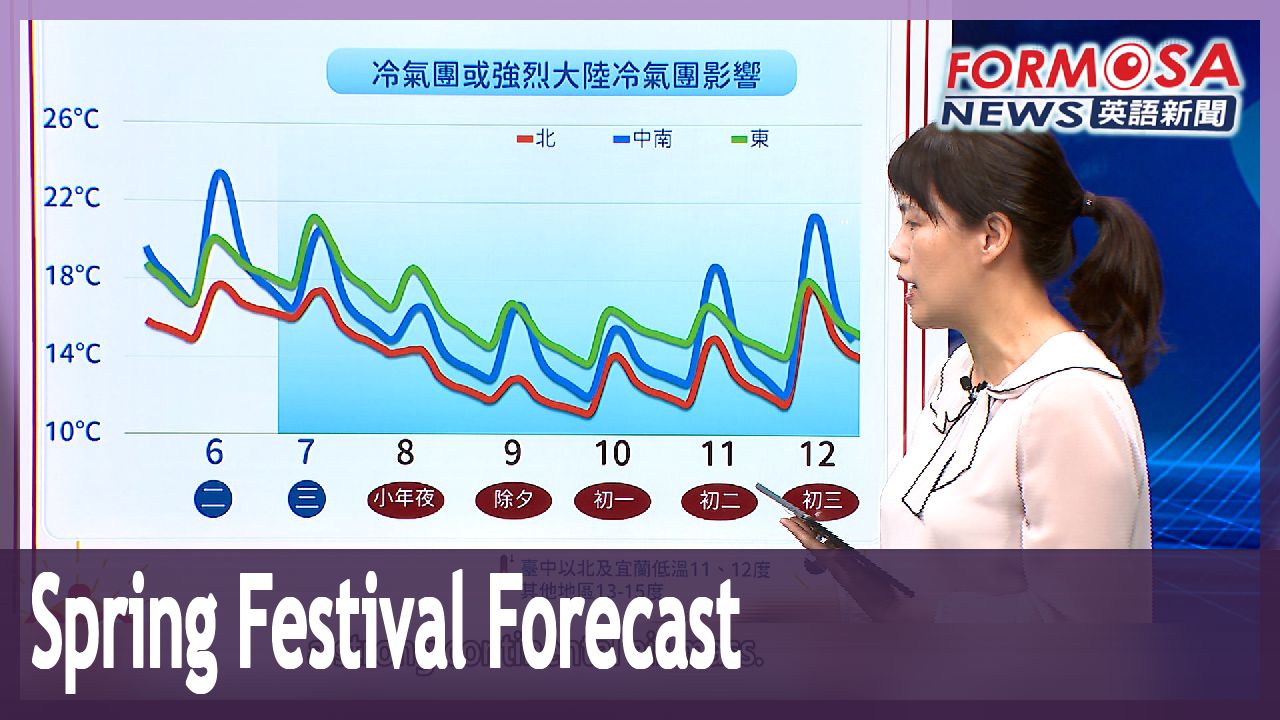
Turning now to your weather. Forecasters say that a cold air mass will sweep in Wednesday, bringing damp and chilly weather to all parts of Taiwan until Friday, or Lunar New Year’s Eve. Conditions will start to dry up over the weekend, but low temps are expected to linger across the West Coast. Let’s hear from a forecaster.
Chen I-hsiu
Central Weather Administration forecaster
At 7:30 p.m. yesterday, this year’s first lightning storm, or what we call “spring thunder,” occurred in Matsu. Early today at 5 or 6 in the morning, spring thunder was also reported in the region from Taoyuan to Hsinchu. Starting Feb. 7, the weather will be affected by a cold air mass, a strong continental air mass. Low temperatures will be felt for several days, particularly on the morning of Lunar New Year’s Eve, New Year’s Day, and the second day of the Lunar New Year. Parts of Taiwan, and especially Northern Taiwan, could see lows of 10 degrees or below.
From Wednesday to Friday, you can expect lows of 11 degrees or less along the upper half of the island. Temperatures will only be slightly higher in other areas, with lows from 13 to 15 degrees. In the north, there will be a chance of heavy localized showers and snow at altitudes above 3,500 meters.
For more Taiwan news, tune in:
Sun to Fri at 9:30 pm on Channel 152
Tue to Sat at 1 am on Channel 53
馬祖"春雷第一響"! 週三起濕冷到除夕 北部低溫11度
2024-02-05
今年的第一聲春雷,週日晚間在馬祖出現,而春雷響了之後,各地將逐漸轉冷,週三冷氣團報到,全台將一路濕冷到除夕。而初一之後,雖然水氣減少,但氣溫依舊偏低,轉為乾冷的天氣型態,西半部還要留意日夜溫差。
[[氣象署預報員 陳伊秀]]
“昨天(2/4)的晚上七點半,馬祖地區有今年第一道春雷,今天(2/5)清晨大概五、六點的時候,桃園到新竹這個區塊也有春雷的現象。2/7開始,會受到冷氣團,或強烈大陸冷氣團的影響,會持續好幾天都屬於低溫偏低的情況,尤其是在除夕夜、初一、初二清晨,局部地區,尤其北台灣可能也有機會下探到10度左右。”
週三到週五,台中以北和宜蘭低溫下探11度,其他地區也只有13至15度,而且北台灣的降雨時間持續、有局部大雨發生機會,3500公尺以上高山,如果水氣和溫度配合,也不排除會降雪。
更多新聞內容,請鎖定:
民視台灣台(152頻道)週日至週五晚上9:30
民視新聞台(53頻道)週二至週六凌晨1:00
Related News