Sizzling temps, afternoon thunderstorms to prevail
Sizzling temps, afternoon thunderstorms to prevail
2024-07-09
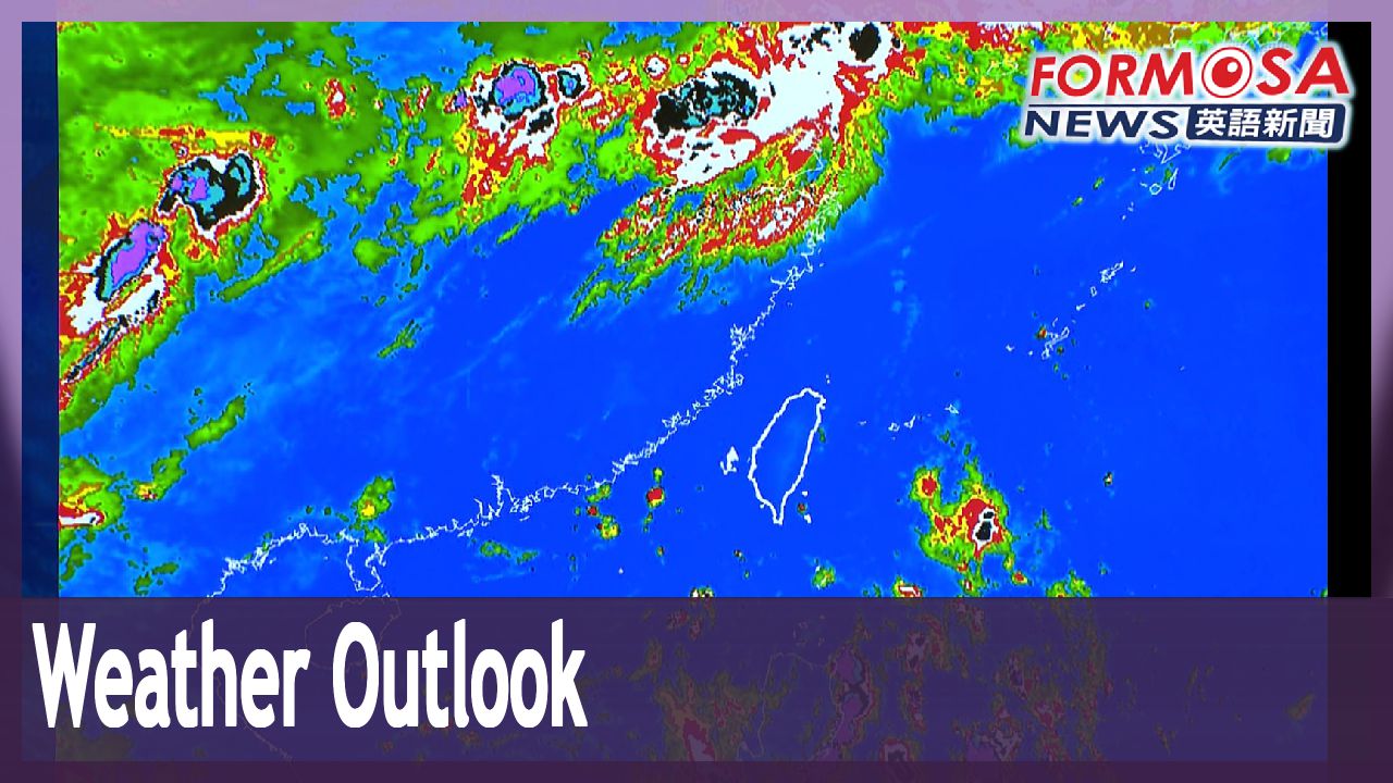
‘Tis the season for scorching temperatures and afternoon thunderstorms. Sudden downpours have been striking islandwide, and in some parts of the south, highs have exceeded 36 degrees for nine days in a row. Forecasters say that this summer weather pattern is likely to continue over the near term. But despite it being the prime time for typhoons, there are still no tropical storms forming on the horizon.
It’s hot, hotter and hottest. The Central Weather Administration has been issuing orange heat alerts every day. In Tainan, Kaohsiung, and Pingtung, temps have exceeded 36 degrees for nine days straight.
Wu Wan-hua
Central Weather Administration
The area affected by rains won’t be as large as yesterday, but the convective cloud systems are still picking up strength. Tomorrow we can expect more moisture and lower atmospheric stability, leading to more pronounced afternoon thunderstorms. We’re expecting localized heavy rains in the greater Taipei area and in mountainous areas.
Sudden afternoon storms have been common in many parts of Taiwan. Earlier in the week in Nantou and Alishan, the storms even brought hailstones.
Wu Wan-hua
Central Weather Administration
High pressure below causes the air to heat up. Above, it’s colder, and so that causes convection currents. That can easily trigger movements in convective cloud systems, creating vigorous convection currents in the atmosphere. A cold-core low has been affecting our weather since last weekend, and over the past few days. But as of today, the cold-core low has moved toward the coast of Guangdong.
Summer is typhoon season, but so far, no tropical depressions have formed near Taiwan. Experts say that’s rather unusual.
Voice of Wu Sheng-yu
Weather analyst
This year, the numbers are indeed on the lower end. Climatologically, we should’ve seen at least three or four tropical storms form by now. After next week, the North Pacific High will shift northward, leaving more space in southern seas, resulting in a higher chance of tropical disturbances.
The weather expert says that so far, only two tropical storms have formed in the Western Pacific, both far from Taiwan. That’s much fewer storms compared to previous years. The world is feeling the impact of climate change and extreme weather events, and Taiwan is no exception.
For more Taiwan news, tune in:
Sun to Fri at 9:30 pm on Channel 152
Tue to Sat at 1 am on Channel 53
南部連9天逾36度高溫! "無熱低壓生成" 專家:不尋常
2024-07-09
每天都好熱!台北及台中以南,全都亮起高溫警示燈號,南高屏已經連續九天,可能出現36度以上高溫。再加上午後又急又大的雷陣雨,何時能到盡頭,氣象署坦言,目前看起來還會持續一段時間。不過進入颱風季,今年到現在都還沒有熱帶性低氣壓生成的跡象,專家也坦言,不太正常。
熱熱熱,氣象署高溫警示燈號這幾天沒停過,尤其南高屏已經連續九天,飆出36度高溫。
[[氣象署簡任技正 伍婉華]]
“今天(9)所下的雨,當然整個範圍來比起來,不會像昨天那麼多,但是今天午後對流雲系還是發展的旺盛,明天水氣又比今天來得多,大氣穩定度比今天來得低,所以明天午後雷陣雨又會比今天來得明顯,我們預估明天在大台北地區,以及其他各地山區,會出現局部性的大雨”
午後雷陣雨,又急又大,劇烈天氣,昨天南投、阿里山,甚至下起冰雹。
[[氣象署簡任技正 伍婉華]]
“(高壓) 在底下一直在燒,然後上面又比較冷,所以會加強它的對流,因此會容易引起旺盛對流的雲系運動,造成很旺盛的對流雲系在我們上空發展,其實這個冷心低壓,它在上個週末,也就是在過去的幾天,都已經影響我們天氣,而這個冷心低壓,今天已經移動到廣東沿海”
不過進入颱風季,今年到現在都還沒有熱帶性低氣壓生成的跡象,專家也坦言,不太正常。
[[聲源:天氣分析師 吳聖宇]]
“數目上來說,目前看起來的確是偏少,氣候上來講,現在最少要有三到四個以上的颱風發展。下個禮拜之後,太平洋高壓的位置會比較往北邊移動,南邊的熱帶洋面上,讓出來的空間就會變得比較大一點 ,發展出一些熱帶擾動的機會就會變得比較高。”
天氣分析師坦言,進入颱風季,但西太平洋至今只有兩個颱風生成,而且都離台灣好遠,數量跟往年相比,確實偏少。全球暖化、極端氣候,明顯衝擊台灣天氣。
更多新聞內容,請鎖定:
民視台灣台(152頻道)週日至週五晚上9:30
民視新聞台(53頻道)週二至週六凌晨1:00
Related News