Typhoon Gaemi downpours in south comparable with 2009 Typhoon Morakot
Typhoon Gaemi downpours in south comparable with 2009 Typhoon Morakot
2024-07-26
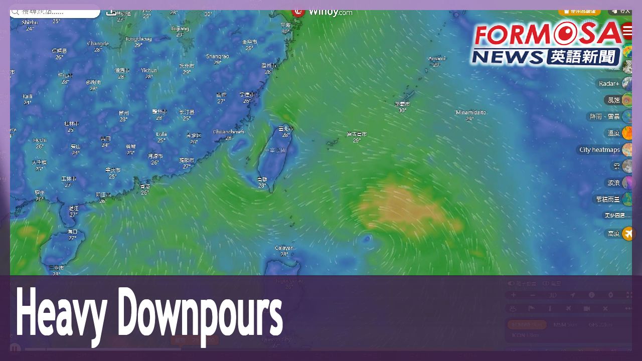
Typhoon Gaemi delivered torrential downpours to Taiwan. Meteorologists say the levels of precipitation are comparable to Typhoon Morakot back in 2009. This time around, the typhoon’s outer bands were much broader on the southern side, leading to heavy showers in central and southern Taiwan. Though the storm has moved away from Taiwan, its tail could still bring heavy rains to the south. Let’s hear from the Central Weather Administration.
Hsu Chung-yi
Central Weather Administration
The storm’s outer bands are blocked by the topography. So the rains are particularly pronounced in the western half, especially in mountainous regions of central and southern Taiwan.
Chen Yi-liang
Central Weather Administration
Rains were not so heavy in the mountainous areas of Pingtung, but in the rest of Southern Taiwan, both down in the plains and in the mountains, precipitation levels were on par with Typhoon Morakot. That’s a significant amount of rainfall. When storms emerge from low pressure systems, it’s quite common for the periphery and the storm itself to interact once the southern side picks up moisture. That develops into powerful currents that can pick up strength without making contact with the topography. That’s why this time the downpours down in the plains were so heavy.
Already, another tropical disturbance is taking shape in the Philippine Sea. Meteorology enthusiasts on social media say that the system could arrive in Taiwan as early as next Tuesday. According to European and American models, there is a moderate chance that the disturbance will strengthen into another tropical storm.
For more Taiwan news, tune in:
Sun to Fri at 9:30 pm on Channel 152
Tue to Sat at 1 am on Channel 53
凱米跟莫拉克同等級! 菲律賓東方恐又有颱風生成
2024-07-26
凱米颱風替台灣帶來驚人雨量,氣象署直言,和2009年的莫拉克颱風,幾乎是"相同等級"。尤其凱米南側伴隨非常寬廣的外圍環流,持續替中南部帶來降雨,中南部的民眾依舊要嚴防颱風尾帶來的雨勢。
[[氣象署科長 徐仲毅]]
“外圍環流的雨帶之外,其實還有一些地形上的鎖定,所以其實除了整個西半部地區,特別是中南部的山區,今天的降雨都是相當明顯”
[[氣象署預報中心主任 陳怡良]]
“除了屏東的山區略少,南部的四個縣市,平地跟山區,幾乎都跟莫拉克是在同一個等級,這都是非常顯著的降雨。一個大低壓帶裡面生成颱風,很容易有的現象,就是它的南側一旦伴隨著旺盛水氣,外圍環流跟本身環流的交互作用,其實很多旺盛的對流,是不需要碰到地形就已經開始發展,所以也才造成這一次的平地,有非常顯著的降雨”
然而凱米前腳剛走,菲律賓東方海面上,又有一個熱帶擾動正在發展,氣象粉專分析,根據歐美模式預估,這個系統最快下週二就會抵達台灣附近,有"中等機率"會生成下一個颱風。
更多新聞內容,請鎖定:
民視台灣台(152頻道)週日至週五晚上9:30
民視新聞台(53頻道)週二至週六凌晨1:00
Related News