Sea warning for Typhoon Koinu expected at 11:30 p.m.
Sea warning for Typhoon Koinu expected at 11:30 p.m.
2023-10-02
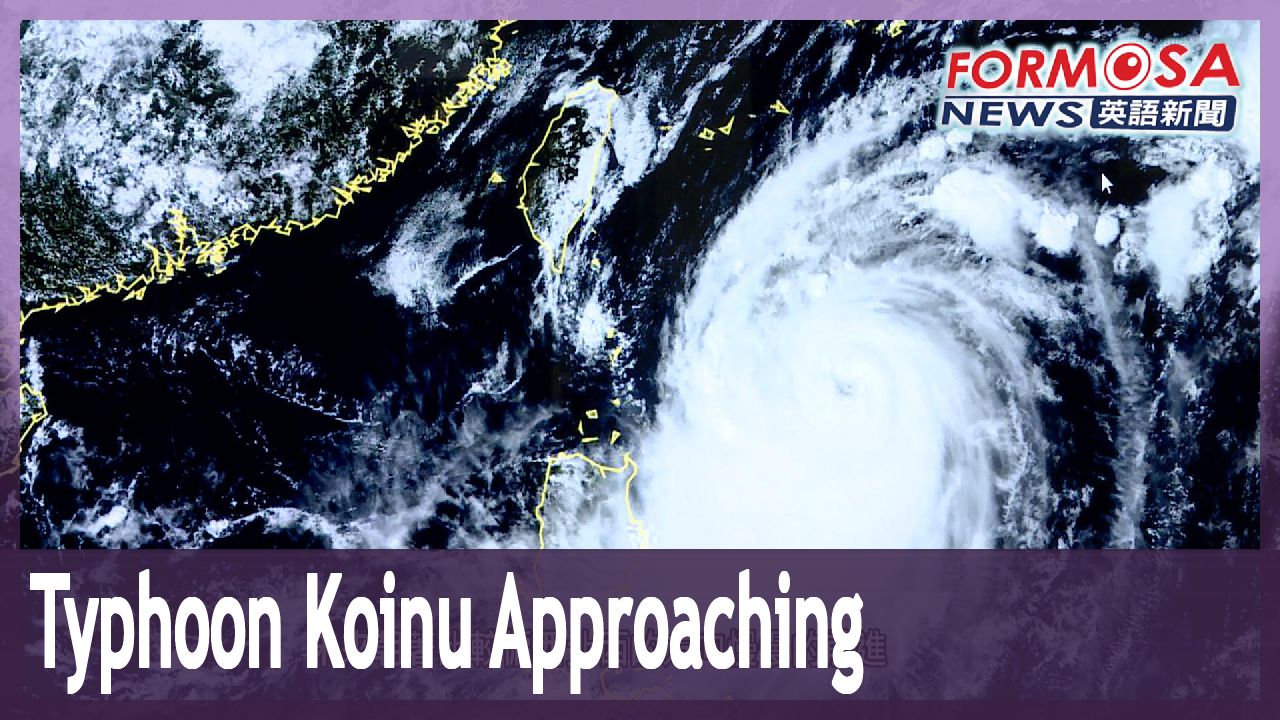
Typhoon Koinu is moving in. A sea warning is expected tonight at 11:30, followed by a land warning as early as Tuesday afternoon. According to the Central Weather Administration, Taiwan will feel the storm’s strongest impact between Wednesday and Friday. The first land warnings are expected for Hualien, Taitung, and the Hengchun Peninsula.
Kuan Shin-ping
CWA forecaster
It is located approximately 600 to 700 kilometers out in the southeastern waters. Its structure is highly symmetrical and robust, and it’s expected to gradually chart a northwesterly course. As for its predicted trajectory, we expect it to move across Southern Taiwan, then move toward the Bashi Channel, before heading south of the Taiwan Strait. The first land warnings will include areas where it’s likely to make landfall, particularly Hualien, Taitung, and the Hengchun Peninsula. Based on this trajectory, the southern cities and counties will see the greatest impact.
Forecasters warn of strong winds and tall waves starting on Tuesday. Typhoon Koinu will be this year’s second major storm to make landfall.
For more Taiwan news, tune in:
Sun to Fri at 9:30 pm on Channel 152
Tue to Sat at 1 am on Channel 53
"小犬"中颱襲台! 最快今晚發海警.明下午發陸警
2023-10-02
中度颱風小犬要來了,氣象署預計週一晚間11點半,發布海上颱風警報。最快週二下午,就會發陸警。小犬主要影響台灣期間,落在週三到週五,第一波陸警範圍,將會是花東跟恆春半島。
[[中央氣象署預報員 官欣平]]
“東南方的海域大概600到700公里的這個海面上,那它的結構非常的對稱,而且非常的紮實,未來朝著比較偏西北西的方向慢慢的前進。未來預估的路線呢,會經過我們台灣南部的陸地,到巴士海峽一帶,最後朝著台灣海峽南部前進。(首波陸警)涵蓋到這個範圍,自然就是我們說可能登陸地點的,比較偏花東、恆春半島一帶這樣子,那後續延伸它這樣的路徑,比較影響的就是南部的各個縣市。”
氣象署示警,週二強風、長浪搶先來報到。小犬類似海葵的路徑,以中颱之姿,朝東半部、南部直撲而來,今年第二個登陸颱風,威力不容小覷。
更多新聞內容,請鎖定:
民視台灣台(152頻道)週日至週五晚上9:30
民視新聞台(53頻道)週二至週六凌晨1:00
Related News